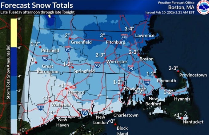
URGENT UPDATE: A fast-moving storm is set to hit Rhode Island this afternoon, bringing 1 to 2 inches of snow across the northern two-thirds of the state. According to the National Weather Service, the snowfall will begin later today, February 10, and continue into the night, adding to the already significant snowpack on the ground.
While the northern regions brace for accumulation, the southern portion of Rhode Island is expected to see a mix of rain and less than an inch of snow. In comparison, parts of Massachusetts could receive up to 3 to 4 inches of snow, indicating the storm’s varying impact across the region.
Currently, Rhode Island is grappling with the aftermath of a frigid winter, having recorded over 20 inches of snow in January alone. With 2.6 inches already registered in February, the Providence area still has about 10 inches of snow on the ground, according to local weather authorities.
February has been particularly harsh, with an average temperature of 19.9 degrees, making it 10.5 degrees colder than usual during the first nine days. January was also notably cold, averaging 27.4 degrees, which was 2.8 degrees below the norm.
In an encouraging turn, the extreme cold is expected to ease this week. Today’s high in Providence is projected to reach 34 degrees, with temperatures hovering between 35 and 36 degrees through Saturday. This gradual warming may bring some relief to residents enduring the winter chill.
Forecasters are also keeping a close eye on potential coastal storms this weekend, which could further impact the region. Stay tuned for updates as conditions develop.
This storm serves as a reminder of the harsh realities of winter, impacting transportation, daily activities, and the well-being of residents across Rhode Island. Prepare accordingly to stay safe and warm as the snow falls tonight.