UPDATE: The Bay Area is bracing for another wave of rain today, with weather officials warning residents to stay alert for potential flooding. The rain is expected to continue into the night before transitioning to a colder, dryer weather pattern.
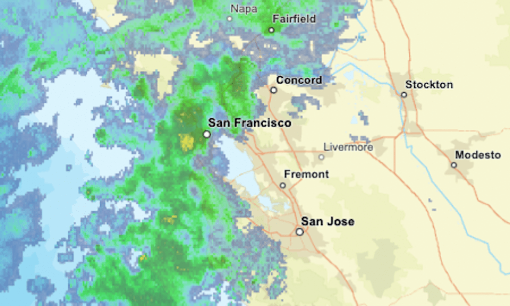
Weather forecasters have confirmed that as of Monday morning, light to moderate rain is impacting several areas across the Bay Area. The radar map shows precipitation in green, with heavier downpours indicated in yellow and orange. This storm follows a weekend system that left some cities grappling with minor flooding.
URGENT WARNING: Authorities are particularly concerned about the Lake Tahoe area, where light to moderate snow is expected. A winter storm warning is currently in effect for the northern Sierra Nevada, Mount Shasta, and the Siskiyou Range, where residents can anticipate heavy snow and strong winds.
As rainfall continues across parts of California, the risk of flooding remains high, especially in areas already affected by high tides and king tides boosted by the recent super moon. Emergency services are on standby, prepared to respond to any urgent incidents as the storm progresses.
Residents in the Bay Area are urged to remain vigilant and monitor local updates throughout the day. Expect conditions to shift rapidly as this storm moves through, with officials emphasizing the importance of safety and preparedness.
As the rain subsides tonight, a period of dryer and colder weather will follow, bringing a much-needed reprieve to the soaked region. Stay tuned for updates as conditions develop and more information becomes available.