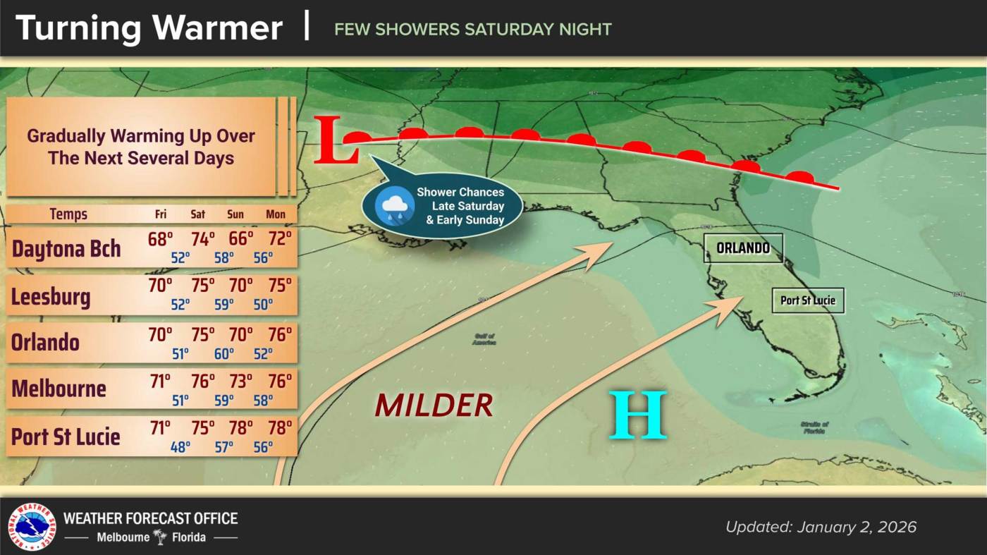
UPDATE: Central Florida is experiencing a significant warm-up as temperatures are set to reach around 70°F today, January 6, 2023, before a cold front moves in over the weekend. The National Weather Service (NWS) in Melbourne confirms that overnight lows will rise to the upper 40s, indicating a shift from the winter chill.
Residents can expect dry conditions today as high pressure drifts east across the Florida peninsula. Light westerly winds will prevail, but cloud cover will begin to increase tonight ahead of the approaching front. The NWS warns that while Friday will remain dry, rain is likely on Saturday night into Sunday as the front sweeps through.
Tomorrow, temperatures are expected to climb to the mid-70s, with a noticeable cooling trend following the passage of the front. Sunday’s highs will likely remain in the 70s across much of the region, but areas north of Interstate 4 may see temperatures dip into the upper 60s. Overnight lows will settle in the 50s, setting the stage for a cooler Sunday.
The NWS states, “Southwesterly flow increases locally ahead of the front, becoming up to 10-15 mph north of I-4 in the afternoon, with a few gusts near 20 mph.” This change in wind is expected to usher in moisture and potential rain, with scattered showers likely on Sunday.
Looking ahead, the beginning of next week promises warmer temperatures, with highs projected to soar into the upper 70s to lower 80s by Thursday. Overnight lows will remain in the 50s, while coastal areas may experience temperatures in the lower 60s.
Residents are advised to stay informed about the changing weather conditions and prepare for possible rain as the weekend approaches. This developing situation will impact weekend plans, and preparations for cooler temperatures should be made accordingly. Check back for the latest updates from the NWS as the weekend unfolds.